UN
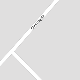
71 Churchgate
£ 239,950
Description
We don't have a Description for this property.
- Bedrooms
- 3
- Bathrooms
- 0


Leaflet © OpenStreetMap contributors
The heatmap indicates the level of crime in the area. The color of the heatmap indicates the crime severity and recency.
Metrics Year-on-Year
- Average area value
- 256,098.00 £Decreased by 14.07 %
- Average area rental value
- 1,156.00 £/moDecreased by 1.62 %
- Est rental Yield
- 5.42 %Increased by 14.59 %
- Crime Rate
- 3.00 %Unchanged by 0.00 %
from 298,041.00 £
from 1,175.00 £/mo
from 4.73 %
from 3.00 %
Nearby Schools
| Name | Type | Ofsted | Distance |
|---|---|---|---|
| St Patrick'S Catholic Primary School | Voluntary Aided School | Outstanding | 0.83 KM |
| Bishop David Sheppard Children'S Centre | Children's Centre Linked Site | 0.98 KM | |
| Churchtown Primary School | Academy Converter | 1.09 KM | |
| Bishop David Sheppard Church Of England Primary School | Voluntary Aided School | Good | 1.16 KM |
| Holy Family Catholic Primary School | Voluntary Aided School | Good | 1.33 KM |
Images
Nearby Streets
| Name | Average Price | Average Sqft | Distance |
|---|---|---|---|
| Montrose Drive | £ 276,590 | 0 | 0.00 KM |
| Beresford Drive | £ 295,000 | 0 | 0.00 KM |
| Moss Lane | £ 409,000 | 0 | 0.00 KM |
| Fine Jane's Way | £ 0 | 0 | 0.00 KM |
| Darwin Court | £ 0 | 0 | 0.00 KM |
Nearby Transport
| Name | NLC | TLC | Distance |
|---|---|---|---|
| Meols Cop | 2357 | MEC | 1.25 KM |
| Southport | 2262 | SOP | 3.71 KM |
| Birkdale | 2352 | BDL | 5.46 KM |
| Hillside | 2231 | HIL | 7.10 KM |
| Bescar Lane | 2351 | BES | 7.13 KM |
Nearby Listings
| Address | Price | Type | Score | Distance |
|---|---|---|---|---|
| Churchgate, Churchtown | £ 500,000 | BUY | 7 / 10 | 0.07 KM |
| Churchgate, Churchtown, Southport, PR9 | £ 300,000 | BUY | Unknown | 0.20 KM |
| Churchgate, Southport, PR9 7JH | £ 400,000 | BUY | 7 / 10 | 0.20 KM |
| Kings Hey Drive, Churchtown, Southport, PR9 | £ 230,000 | BUY | 5 / 10 | 0.22 KM |
| Churchgate, Southport | £ 375,000 | BUY | Unknown | 0.22 KM |
Nearby Properties
| Address | Price | Distance |
|---|---|---|
| 83 Churchgate | £ 285,000 | 0.00 KM |
| 60 Churchgate | £ 330,000 | 0.00 KM |
| 90 Churchgate | £ 337,500 | 0.00 KM |
| 70 Churchgate | £ 240,000 | 0.00 KM |
| 84 Churchgate | £ 239,950 | 0.00 KM |